Looking To The Sky

Jason's aerial adventures

 
  • Home
  • About
  • Categories
    • Buying An Airplane
    • Flights
    • Private Pilot Completion
    • Instrument Rating Completion
  • Flown Airports
  • Ratings
    • Private Pilot Certificate
    • Instrument Rating
    • Commercial Pilot Certificate
  • Go Fly?
Menu
  • Home
  • About
  • Categories
    • Buying An Airplane
    • Flights
    • Private Pilot Completion
    • Instrument Rating Completion
  • Flown Airports
  • Ratings
    • Private Pilot Certificate
    • Instrument Rating
    • Commercial Pilot Certificate
  • Go Fly?
  • Long Distance Solo Cross Country

    Today was a huge achievement.  After much preparation I finally flew my long distance cross country flight.

    Requirement: 1 solo cross country flight of at least 150nm total distance with full stop landings at 3 points and one segment of at least 50nm between T/O and landings.

    I spent a chunk of my evening the day before the flight mapping it out and getting all my navigation points in check.  This made the flight itself so much easier the day of!

    Preppin'

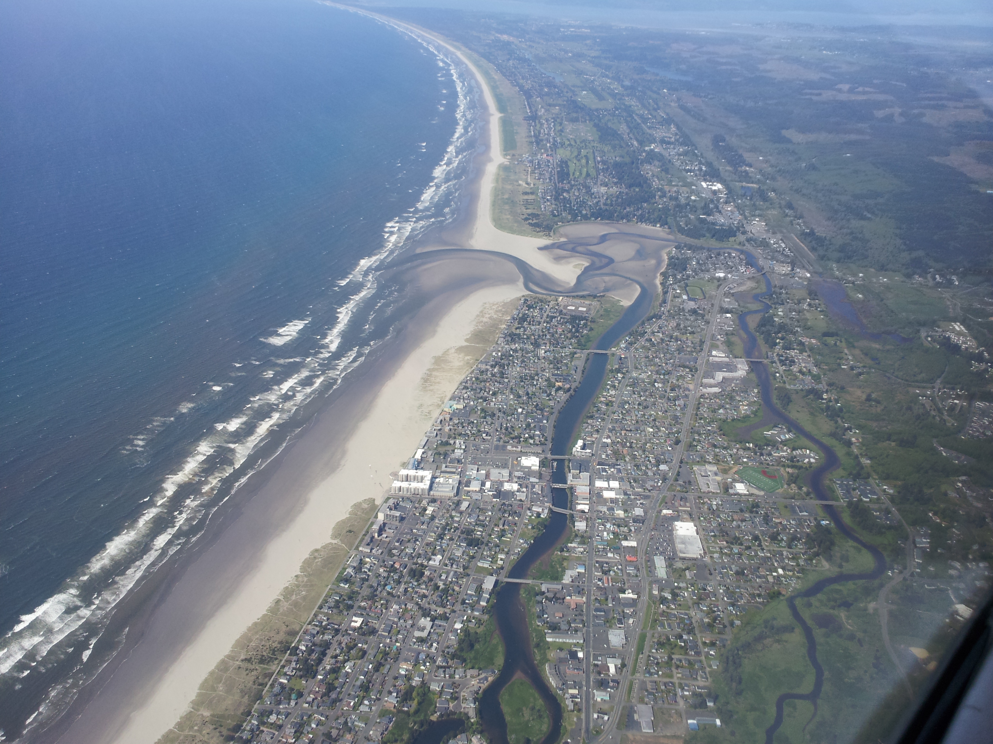
    What a beautiful flight it was (look at the pictures below)!

    The flight was to the gorgeous Oregon coast towards Tillamook, then north up to my fist stop: Astoria Regional Airport.  This section alone of the flight made the entire trip worthwhile.  It was such a lovely day that the water and the ground with the reflection of the sun just lit up.

    Coastal Reflections

    After playing around the area of Astoria, I made my way over to another new airport for me: Kelso Airport (Southwest Regional Airport).  I followed this up by making a direct through the Battleground VOR (BTG) back home to Troutdale.

    The flight was busy with new airports and procedures happening, however I was able to relax a bit to and take some great shots.

    I feel navigating with VORs is much easier now than it was when I first started figuring them out.

    Along with flying to some new airports, I also learned a new procedure: logging a flight plan in the air.

    Using the McMinnville RCOs around the area, on my journey up from Tillamook over to Astoria, I logged a flight plan from Astoria to Kelso to Troutdale.  This was surprisingly easier than I was expecting.  I gave them all the information I already had written down and when I was taking off from Astoria I activated the flight plan.

    My time was pretty much spot on when I landed into Troutdale, and though I forgot to close my flight plan before shutting the plane down, I did get the radios back on and closed my plan to avoid any rescue teams being called out.

    The majority of my flight was navigating using VORs with the legs from Tillamook up to Astoria over to Kelso all being pilotage without using any aids.  Just comparing my navigational chart (map) to the ground.

    This was by far one of my best flights I’ve ever had and though it wasn’t cheap, it was something I’ll remember for quite a while.  I realize even more that I can’t wait to wrap this license up so I can share it with my friends and family!

    Until then – keep looking to the sky!

    Logs

    Flight Time: 2.5 Hours
    Landings: 3


    Related

    May 1, 2013 / Jason / Comments Off on Long Distance Solo Cross Country

    Categories: Private Pilot Completion

    Tags: Cessna 172, cross-country, flying, KAST, KKLS, KTMK, KTTD, N5201H, Solo, Training, VFR, VOR

    Gone A Month? Go Practice Landings! An Update – About time!

    Comments are currently closed.

Logbook

  • Total Flight Time: 318.5 Hours
  • Pilot In Command Time: 224.7 Hours
  • Solo Time: 300.6 Hours
  • >50NM Cross Country Time: 95.2 Hours
  • >50NM Cross Country Time (Solo): 62.5 Hours
  • Night Time: 8.5 Hours
  • Simulated Instrument Time: 4.8 Hours
  • Landings (Day/Night): 617 (593/24)
  • Flight Training Received: 92.8 Hours
  • Ground Training Received: 30.8 Hours

Updated 5/2/2019

Archives

Links

  • Aviation Weather
  • Jason Gets Around
  • Jason's Main Blog
  • The Art of Non-Conformity

Recent Posts

  • Goodbye N79434
  • I’m Still Flying (I’m not dead)!
  • Last Year I Bought A Plane
  • Night and Morning Flights around Downtown Portland
  • Early Morning Downtown Portland with David and Ann

My Airspace

Flight Planning at SkyVector.com

Meta

  • Log in
  • Entries feed
  • Comments feed
  • WordPress.org
 

Recent Posts

  • Goodbye N79434
  • I’m Still Flying (I’m not dead)!
  • Last Year I Bought A Plane
  • Night and Morning Flights around Downtown Portland
  • Early Morning Downtown Portland with David and Ann
  • Completed My First Biennial Flight Review
  • So, I Bought An Airplane
  • Train Tracks To Eugene with Evan
  • Downtown Portland with Josh and Meredith
  • Mt. St. Helens with Melissa, Tomas, and Kristen

Tag Cloud

    Cessna 172 cross-country emergency procedures Emily flight-track flying IFR James K4S9 K7S3 K7S9 KMMV KSLE KSPB KTMK KTTD KUAO Maneuvers Mountain Mt. St. Helens N172MR N734KU N2108Y N5201H N66589 N75542 N79434 no-flight Portland Rick schedule Slips Slow Flight Solo Stalls steep turns Steve Testing Tillamook Training Turns VFR Video VOR Weather

Pages

  • About
  • All
    • Flights
    • Private Pilot Completion
  • Commercial Pilot Certificate
  • Flight Review
  • Flown Airports
  • Go Fly?
  • Instrument Rating
  • Private Pilot Certificate

Categories

  • Annual (3)
  • Buying An Airplane (4)
  • Flights (27)
  • Instrument Rating Completion (3)
  • Private Pilot Completion (96)
  • Uncategorized (1)
  • Update (1)

Archives

Copyright © 2015 Looking To The SkyTheme created by PWT. Powered by WordPress.org